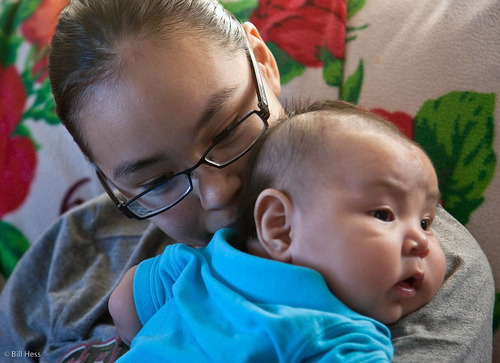
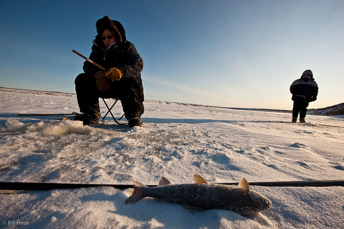
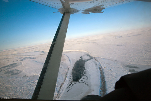
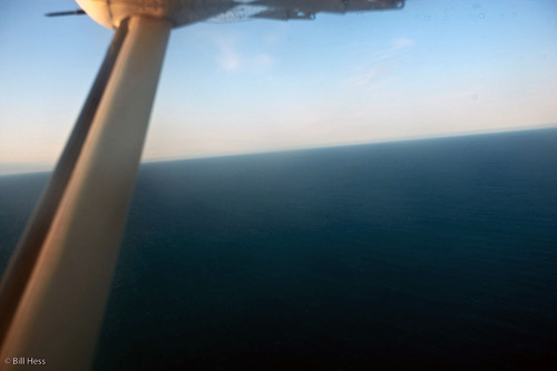
Random pics from yesterday's trip to Atqasuk: the baby, the frozen fish, the frozen river; the unfrozen sea
 Thursday, October 13, 2011 at 2:40PM
 This is Patti Kanayurak of Atqasuk and her baby Levi. They will be in my next Uiñiq, along with more of the family, including Patti's parents and some of her siblings, too.
I will save the writing for Uiñiq, but, essentially, the story deals with a family that has chosen to live a healthy life free from the burdens of alcohol and drugs.
Down on the Meade River, I found people ice fishing. It felt much colder in Atqasuk than it had felt in Barrow and the wind was strong. I do not know what the temperatue was, but from experience I would say a bit above zero F. but with a windchill of -20 or so.
It was cold enough that there was no need or point in bonking a fresh-caught fish on the head - just pull it out, take it off the hook, toss it onto the ice and it is flash-frozen.
Below is an overflow on the Meade River as the Era flight takes us to Wainwright, enroute to Barrow. I was a bit stunned yesterday when I bought my round trip ticket from Barrow to Atqasuk and discovered that the fee was $330 plus.
Atqasuk is 55 nautical miles from Barrow. $330. My original roundtrip ticket from Anchorage to New York was $490. It didn't used to be so bad, and some of it is certainly the price of fuel, but there also used to be three or four air carriers serving Barrow and the villages and now there is one.
In May of 2009, I made what I had intended to be a three-village trip: Barrow, Wainwright, and Point Lay, but I had to drop the Point Lay portion because, even though Point Lay is the next village beyond Wainwright, I could not get a Barrow - Wainwright - Point Lay flight, but only a round-trip from Barrow to Wainwright, and then another round trip from Barrow to Point Lay.
I could not afford it.
I was most struck by the fact that, immediately after that trip, I flew to Bangalore, India, and that ticket was less than the Anchorage-Barrow-Wainwright-Point Lay trip that I had originally planned.
I really miss my plane. This trip would have cost maybe $40 in my own plane, figuring in gas, oil and maintenance.
I have this desire to go nuts, to photograph this place that I love that they call the Alaskan Arctic and the people of it like no one has ever photographed it beofre - including me. But how do I go about it? To really do it right, the way I want to, it would take a budget of between $300,000 and $500,000 a year. That kind of money is not available to me and it is never going to be.
I will just keep at it, one way or another, being grateful for the sometimes substantial support that I have so far received, and see how I much I can get done before my life ends or my health fails.
I'm not done yet, folks. I have lots of work to do, right here in the Arctic.
LOTS.
This morning I had breakfast at Pepe's and so did a fellow by the name of Frankie who eats there just about every day. "I should be standing on the ocean today," he told me. He said that because in the not terribly distant past, most years he could have stood on the ocean today, because it would have been frozen over.
Yes, there would be a lead, but there would also be a broad swath of shore-fast ice and beyond that, the pack ice.
This is what it looked like yesterday from the Era flight - no ice in sight; no shore-fast ice, no pack ice.
When I first arrived in Barrow this trip, I asked a whaler how far out the pack ice was.
"What pack ice?" he answered sardonically.
Then he said it was about 250 miles out.


Reader Comments (2)
"This morning I had breakfast at Pepe's and so did a fellow by the name of Frankie who eats there just about every day. "I should be standing on the ocean today," he told me. He said that because in the not terribly distant past, most years he could have stood on the ocean today, because it would have been frozen over."
"When I first arrived in Barrow this trip, I asked a whaler how far out the pack ice was.
"What pack ice?" he answered sardonically.
Then he said it was about 250 miles out."
Sigh. I won't say a WORD about the USDA growth zone map released in the early 2000s, which showed growing zones shifting northwards en masse from the prior one. Or the new map of Greenland, which shows bare land marching inwards from the previous map, land which used to be covered in thick ice. Or maps showing bark beetle infestations marching northwards, because warmer winters mean more beetle larvae survive and warmer summers mean more trees are stressed and susceptible to bark beetle damage...
Because someone will say it's all a lie and a conspiracy and it isn't really happening, because "Climategate!" Gah.
frightening how fast our surroundings are changing...great pictures